The Samoeng Loop
- Chiang Mai
- Province
- 100 km
- Distance
- Half Day
- Riding time
- November - February
- Best season
- Beginner
- Level
- Road
- Surface
Passes throughChiang MaiMae RimMae Sa ValleySamoengHang Dong
- Sights 5
- Coffee 6
- Food 2
Elevation
- 100 km
- Distance
- 1,490 m
- Total climb
- 1,120 m
- Highest point
- 306 m
- Lowest point
The ride
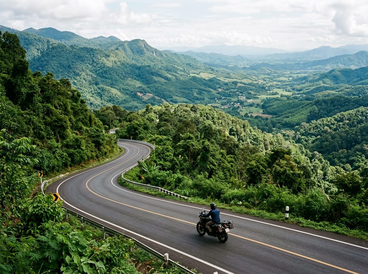
The classic half-day ride out of Chiang Mai. Head north to Mae Rim, turn west up the Mae Sa valley on Road 1096 past the Queen Sirikit Botanic Garden, and climb through the forest to the Samoeng viewpoint. Drop into Samoeng for lunch, then take Road 1269 back over the ridge and down to the canal road. About 100 km of curves with very little traffic once you leave the valley.
Before you go
This track was drawn from a map, not recorded on a ride. Check road conditions locally before you set out.
Along the way
13 places we'd pull over for within 2 km of this route. They are marked on the map above; the distance is how far into the ride each one comes.
Sights5
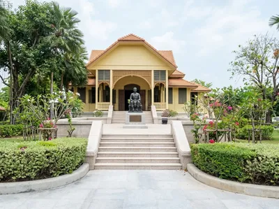
Darapirom Palace Museum
Mae Rim, 15 km in
The teak residence of Princess Dara Rasmi, kept as a museum with her rooms and belongings much as they were. Signed a short way east of the highway at Mae Rim.
Open in Google Maps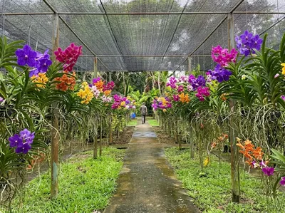
Bai Orchid and Butterfly Farm
Mae Rim, 17 km in
Rows of vanda orchids hanging under shade netting with a butterfly house alongside, on the Mae Rim tourist strip. A short, easy stop between the bigger attractions.
Open in Google Maps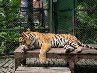
Tiger Kingdom
Mae Rim, 17 km in
The tiger attraction on the Mae Rim road, where visitors are taken into the enclosures with the animals. The restaurant serves a tasty Thai lunch, and you can watch the tigers from there if you're not sure about going into the cages.
Open in Google Maps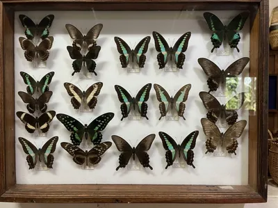
Siam Insect Zoo
Mae Rim, 20 km in
Cases of pinned butterflies and beetles alongside live tanks, in a low-key museum on the Mae Rim road. Better than it sounds if you have any interest in what is flying past you.
Open in Google Maps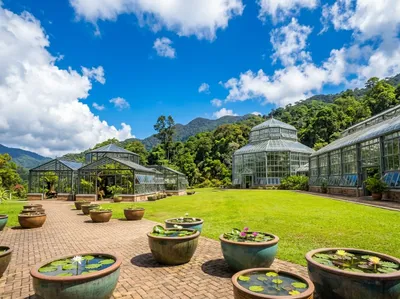
Queen Sirikit Botanic Garden
Mae Rim, 27 km in
Glasshouses and a canopy walkway spread over a hillside in Mae Rim, big enough to lose half a day in. You can ride the internal roads between the sections.
Open in Google Maps
Coffee6
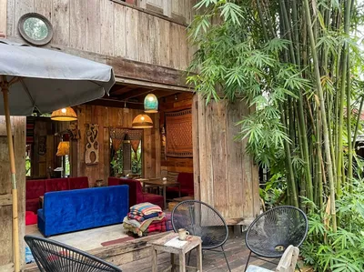
Zombie Cafe
Mae Rim, 20 km in
Open-fronted timber cafe on the Samoeng road out of Mae Rim, with a blue velvet sofa and red seats inside and a bamboo grove crowding the patio. A good first coffee heading north-west out of Chiang Mai.
Open in Google Maps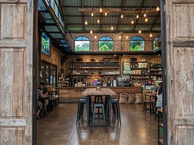
Di Bosco Coffee Specialist
Samoeng, 32 km in
A proper specialty bar in a tall brick and timber room, on the Samoeng loop near the Mae Rim end. Come here if you care which farm the beans came from.
Open in Google Maps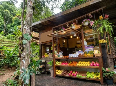
WTF Coffee Camp
Samoeng, 36 km in
Crates of fruit stacked along the counter and coffee poured behind them, on the Samoeng loop road. Simple, cheap to stop at and set up for people arriving on two wheels.
Open in Google Maps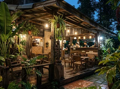
Oui Kaew Coffee
Samoeng, 52 km in
Timber pavilion buried in ferns in Samoeng itself, lit with lamps once the light goes. The obvious place to regroup before heading back over the hill.
Open in Google Maps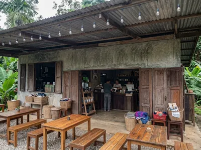
Elefin Farm and Cafe
Samoeng, 69 km in
Farm cafe on the Samoeng loop with an open counter and tables out under the trees. A natural halfway point if you are riding the loop anticlockwise from Hang Dong.
Open in Google Maps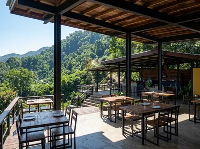
Max Coffee on the Hill
Samoeng, 73 km in
Terraces of timber tables stepping down the hillside above the valley, on the 1269 between Hang Dong and Samoeng. Best on a clear morning before the haze settles in.
Open in Google Maps
Food2
Nut Rim Nam
Hang Dong, 76 km in
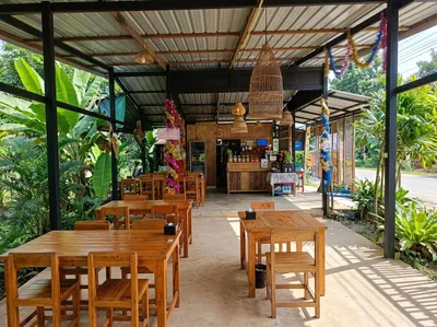
Open-sided dining room with woven fish-trap lampshades over the tables, in the hills west of Hang Dong. Cool once the sun is off the valley.
Open in Google Maps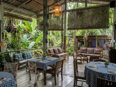
Ozark by Food4Thought
Hang Dong, 81 km in
Checked tablecloths and cane chairs on a shaded veranda among the trees at Hang Dong, on the way out of the city. Service can be painfully slow when it's crowded, so we only go on weekdays.
Open in Google Maps
Photos
More rides nearby
- Distance
- 184 km
- Climb
- 4,390 m
- Level
- Intermediate
- Distance
- 177 km
- Climb
- 4,331 m
- Level
- Intermediate
- Distance
- 223 km
- Climb
- 2,405 m
- Level
- Advanced
- Distance
- 131 km
- Climb
- 1,555 m
- Level
- Intermediate
In these riding guides
Chiang Mai