Doi Inthanon, the Roof of Thailand
- Chiang Mai
- Province
- 214 km
- Distance
- Full Day
- Riding time
- November - February
- Best season
- Beginner
- Level
- Road
- Surface
Passes throughChiang MaiSan Pa TongChom ThongDoi Inthanon
- Sights 4
- Coffee 4
- Food 3
- Stay 4
Elevation
- 214 km
- Distance
- 2,376 m
- Total climb
- 2,557 m
- Highest point
- 284 m
- Lowest point
The ride
A day ride to the highest point in Thailand, 2,565 m above sea level. Ride south to Chom Thong, then follow Road 1009 up through the national park past Wachirathan waterfall and the twin royal pagodas to the summit. It is a long steady climb and noticeably cold at the top, so bring a layer. The national park charges an entrance fee at the gate. Return the same way.
Before you go
This track was drawn from a map, not recorded on a ride. Check road conditions locally before you set out.
Along the way
15 places we'd pull over for within 2 km of this route. They are marked on the map above; the distance is how far into the ride each one comes.
Sights4
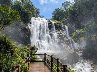
Wachirathan Waterfall
Doi Inthanon, 81 km in
The big one on the Inthanon road, wide enough that the spray reaches the walkway and soaks whatever you leave out. Parking sits right beside it, so it is an easy stop on the climb.
Open in Google Maps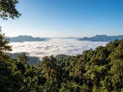
Angga (Inthanon) Nature Trail
Doi Inthanon, 107 km in
The other short trail at the top of Inthanon, ending where the ground drops away and cloud sits in the valley through the morning. Level, and a few hundred metres end to end.
Open in Google Maps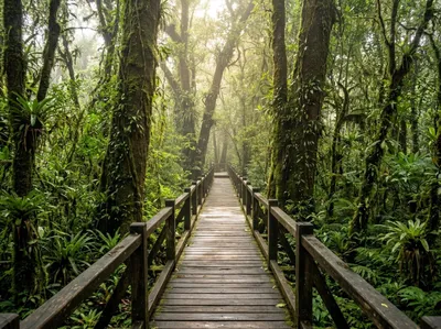
Yod Doi (Inthanon) Nature Trail
Doi Inthanon, 107 km in
The boardwalk at the summit, running through moss-hung cloud forest that stays wet all year. It is cold up there, so wear the jacket you have been carrying.
Open in Google Maps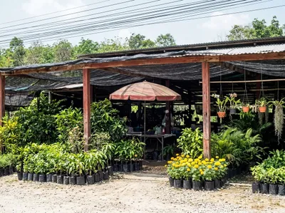
Saturday Buffalo Market
Hang Dong, 189 km in
Stalls of plants, tools and second-hand gear spread along the road on market day, south of Hang Dong. Worth timing a Saturday start around if you like a rummage.
Open in Google Maps
Coffee4
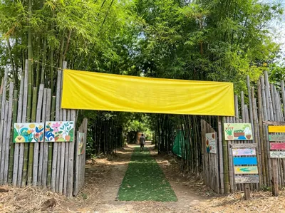
Ganesha Cafe
Hang Dong, 23 km in
A farm cafe reached down a bamboo-lined lane in the Hang Dong flats, easy to fold into a warm-up ride before the loop proper starts. The last stretch in is dirt, so take it gently in the wet.
Open in Google Maps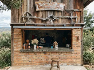
Rimthan Coffee
Doi Inthanon, 87 km in
Carved timber sign over a brick service window, on the road between Chom Thong and the Doi Inthanon gate. Small, quick and useful before you start climbing.
Open in Google Maps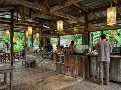
Wabi Sabi
Doi Inthanon, 91 km in
Reclaimed timber and corrugated iron make up the counter here, with paper lanterns overhead. It sits on the road up to the Inthanon summit, so it is a useful last stop before the climb.
Open in Google Maps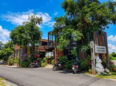
Papa’s Home and Rabbit Cafe
Chom Thong, 161 km in
Shipping containers stacked into a cafe with a giant white rabbit out by the road sign, just north of Chom Thong. Hard to ride past without noticing, which is rather the point.
Open in Google Maps
Food3
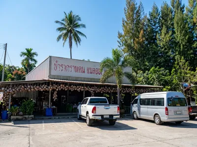
Khao Soi Kalong Coconutland
Chom Thong, 61 km in
Khao soi from a barn hung with coconut shells, next to a petrol station on the 108 at Chom Thong. Fill the tank and the rider at the same stop.
Open in Google Maps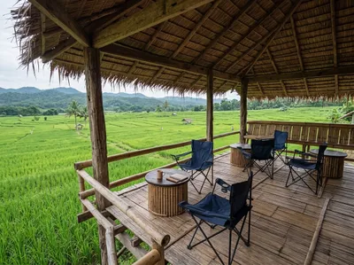
At Home Pizza
Doi Inthanon, 87 km in
Pizza served from a bamboo terrace at the edge of the paddy below Doi Inthanon. Camp chairs, cold drinks and the mountain going dark behind you.
Open in Google Maps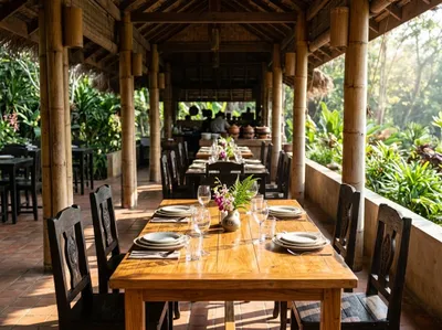
Inthanon Restaurant
Doi Inthanon, 91 km in
Teak tables on an open terrace at the bottom of the Doi Inthanon road, set up for groups coming down off the mountain. Straightforward Thai food and plenty of it.
Open in Google Maps
Stay4
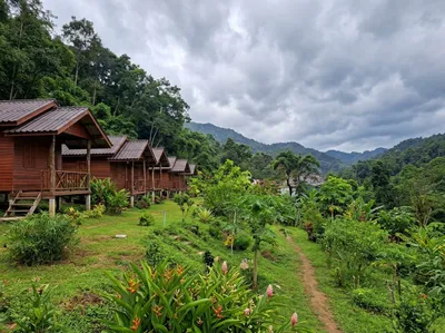
Rangbondoi Mountain Nest
Doi Inthanon, 87 km in
Cabins on stilts stepping up a grass slope below the forest, on the lower slopes of Doi Inthanon, and another birder hangout. Cold enough at night in cool season to want the extra blanket.
Open in Google Maps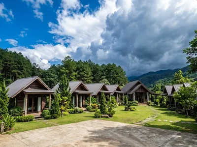
Fin In Doi
Doi Inthanon, 90 km in
A row of dark timber bungalows with covered porches set around a lawn in the Inthanon foothills outside Chom Thong, well placed for an early run up the mountain road. Wide concrete forecourt, so a loaded bike parks easily.
Open in Google Maps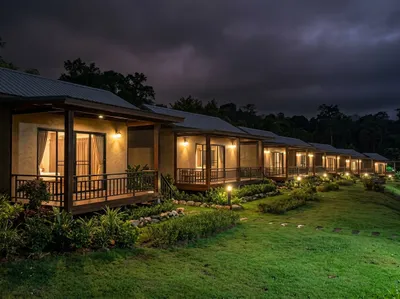
YeeLee Inthanon
Doi Inthanon, 91 km in
A row of small cabins with their own verandas on a lawn near the foot of Doi Inthanon. Like Mr. Deang's Shop, the rooms are basic and cheap, and birders like it for the location. Cool at night, and close enough to be at the summit gate early.
Open in Google Maps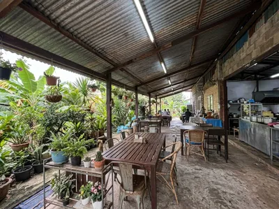
Mr. Deang’s Shop
Doi Inthanon, 91 km in
Part roadside shop and part sit-down on the approach road to Doi Inthanon, with a long timber table under the tin and racks of orchids along one side. Rooms are very basic and cheap, the food simple and good value. A favourite of birders, and the owner is one himself; look for the rare orchid mantis in the garden.
Open in Google Maps
Photos
More rides nearby
- Distance
- 271 km
- Climb
- 4,751 m
- Level
- Beginner
- Distance
- 362 km
- Climb
- 5,484 m
- Level
- Intermediate
- Distance
- 424 km
- Climb
- 5,530 m
- Level
- Beginner
- Distance
- 223 km
- Climb
- 2,405 m
- Level
- Advanced
In these riding guides
Chiang Mai